Prologue
Having raised six children I’m keenly aware they do not retain most childhood memories. I also have my own childhood experience to support that conclusion. My father died when I was three, and that’s the exact number of memories I have of him (one of them was being left in the waiting room at the hospital where he died). Our family moved out west five years later, and I have maybe 30-plus distinct memories from those years preceding our relocation to Nevada (about 5 of which relate to the removal of my right kidney at age 6 due to the discovery of a Wilm’s Tumor). Of course I have many more memories from my teenage years, but I find it remarkable what I cannot recall from my early youth.
Despite the dearth of childhood recollections, I know that my experiences formed and reinforced many of my preferences and biases today. For example, I have the “white coat” syndrome whenever visiting a doctor’s office, causing my systolic blood pressure to jump 30 to 40 points or more. Certainly the experience of my dad dying in a hospital followed by my own cancer fight contributed greatly to that subconscious fear. Another example is my constant yearning to be outside in nature. Except for the coldest part of winter, the woods of New England served as my playground, and the animals and fish in them were of great fascination to me.
Having relocated into the furnace of the Mojave Desert at age 8, my longing to be outdoors laid dormant until my oldest brother, Neal, revived it in my early teen years. My first excursion with Neal was a fishing trip to Groves Lake in Kingston Canyon, which lies in the Toiyabe Range of central Nevada. The second was a hunting trip into the Jarbidge Mountains.
It was the summer between my freshman and sophomore high school years when Neal took me to the Jarbidge Mountains for the August archery mule deer hunting season. My girlfriend (who is now my wife of 39½ years) had recently broken up with me, and I think Neal sensed I needed a distraction. Earlier that spring Neal purchased a recurve bow for me with a pull weight of 45 lbs., and a fletching jig which we used to build our Easton Aluminum arrows. We spent several late afternoons each week driving south on Eastern Avenue in his 1967 Toyota Landcruiser to practice archery skills in Sunset Park’s field archery range. Although I had never before hunted deer with any weapon, it was a heady thrill for a 15-year-old boy to be bow hunting deer the first time out of the gate. Back in the early 1970s bow hunting was not that popular which meant tags were more readily available in the better Game Management Areas (Jarbidge is currently area 072). It took all day for that Landcruiser to make it to the Jarbidge campground, but the remote wildness of Jarbidge made it well worth the travel time.

In my memory, the mountains of Jarbidge were breathtaking. Mule deer were everywhere, more plentiful than I had ever seen before or since. Despite the glorious expectations of that teenage boy, he only had one shot at a deer. I was leading our stalk down a wooded jeep track when we came upon a feeding deer. It never saw or scented us, and when it came within 15 yards I could no longer stand the waiting. When it dropped its head to eat I drew back my bow. I missed it low, right under the rib cage… immense disappointment! Neal was wonderful about it, praising my stalking, my draw back at the right moment… I just needed more practice with the bow.
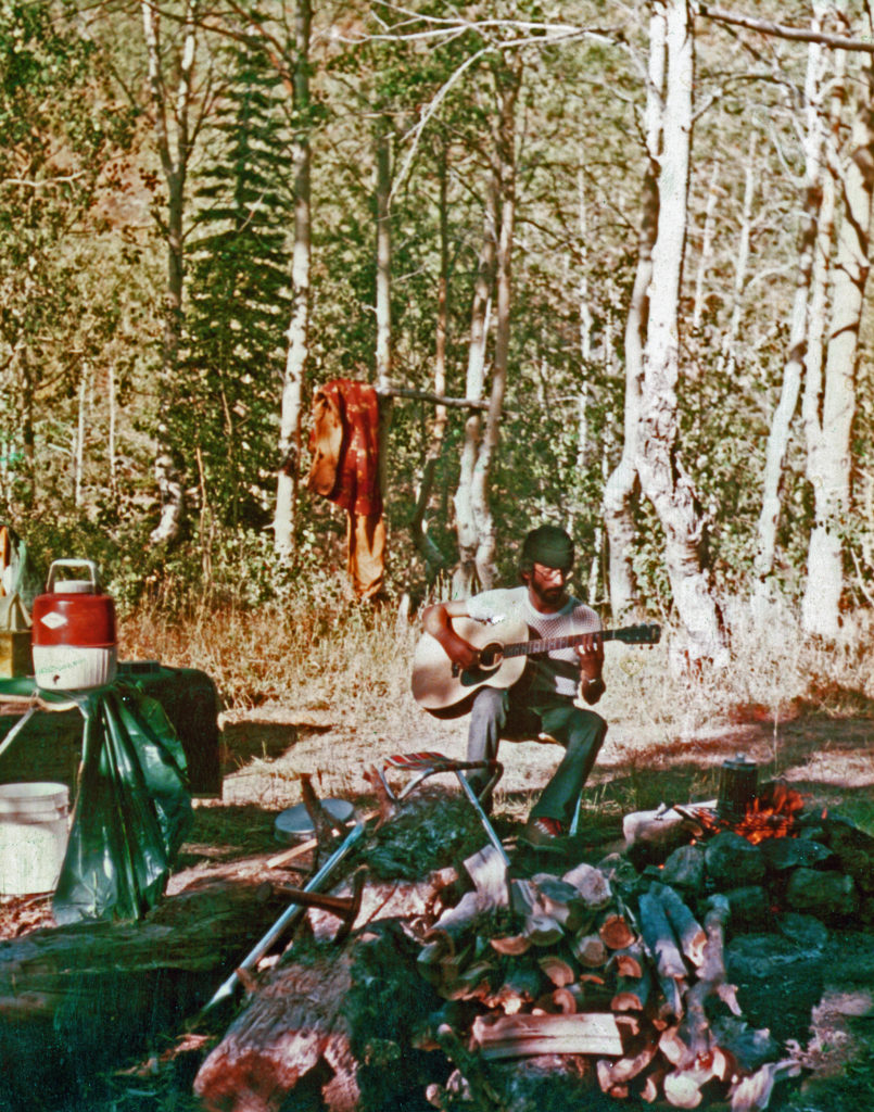
Often adults marginalize youngsters’ knowledge, capacity, and ability. I suppose part of that arises from the desire to instruct them so that they don’t make the same mistakes we made in our youth. Another part may well be that we want to appear the knowledgeable expert even when we are not. I guess there’s a fine balance between letting kids learn the “hard way” and “hovering” over them so that they don’t fail. Personally, I think failing is good. We learn more from our errors than from our successes. Maybe that’s why Neal never taught me how to fly fish. Maybe he knew if the seed was planted within me I would pursue it on my own, learning by trial and error, which is exactly what I did.
The Bible says that “it is good for a man that he should bear the yoke in his youth” while patiently waiting on the Lord (Lamentations 3:27). It also says “Even youths grow tired and weary, and young men stumble and fall” (Isaiah 40:30) just like adults making their journey through life on earth. But then Isaiah goes on to say “but those who hope in the Lord will renew their strength. They will soar on wings like eagles; they will run and not grow weary, they will walk and not be faint.” The process of recognizing we are broken sinners opens us to the redeeming powers of Jesus, so wonderfully described in Psalm 51. Please excuse me for the secular stretch, and the reference to Buddhism, but not only do these words encourage believers to persevere and “finish the race,” but for me they conjure an image of a once youthful angler transitioning into his late years while still searching for fly fishing nirvana.
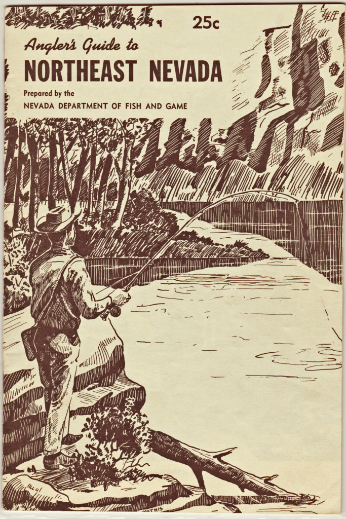
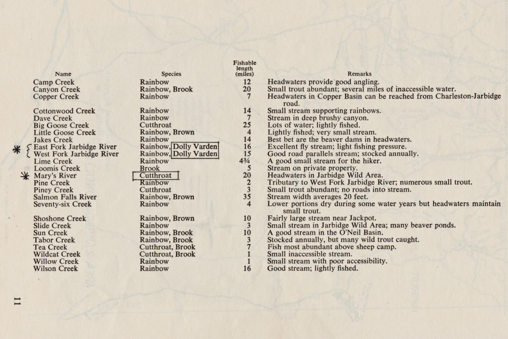
As I grew more into fly angling, another Jarbidge memory persisted. While driving past the West Fork of the Jarbidge River, Neal verbalized what seemed like a thought, “I hope I harvest a deer quickly so I can fish for some Dolly Varden.” Now, Neal was mistaken about the Dolly Varden, but it was only because the Nevada Department of Fish & Game (as they were known then) had incorrectly identified the Bull trout (which is a char, not a trout, similar to the Dolly Varden). The below photo of the Angler’s Guide to Northeast Nevada documents the Department’s faux pas.
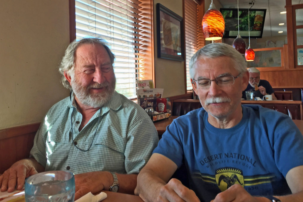
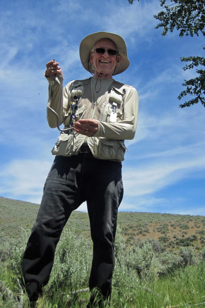
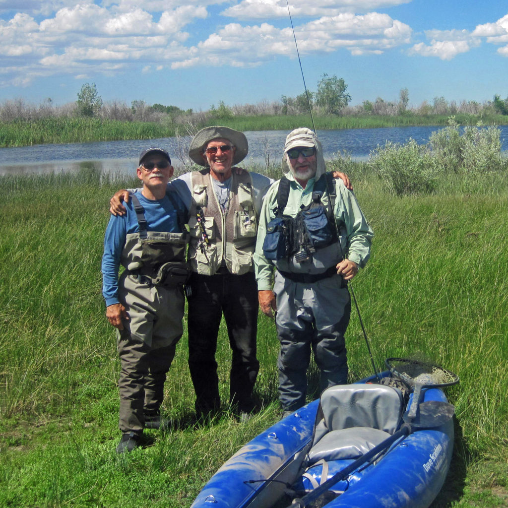
Fast forward about 50 years and I finally relived my youthful dream to return to the Jarbidge area to fish and explore the country. I was pleased it appeared as I recalled; lush, vibrant, high mountain country filled with wildlife and color patterns that overcharged my youthful senses. Best of all, I was accompanied on this adventure with two very close friends, Bill Bergan and Dave Laman. Both Bill and Dave share my propensity for adventure and strong appreciation for the outdoors, and I was blessed that they trusted me enough to join me for this one.
Wild Horse Ranch & Resort
Originally, I conceived of this trip as an overlanding adventure in 4×4 trucks probing into the northeastern Nevada backcountry, camping overnight in tents. If you’ve not heard the term before, “overlanding” is the latest word for car camping, except that it connotes car-camping away from established camp sites (i.e., no running water or pit toilets). There was a possibility that no one else would be interested in such an excursion to destinations so far off and desolate, so I resolved to make the trip alone if necessary. I left clues with friends and family that I’d welcome other adventurers, and fortunately Bill and Dave decided to join me.
I tend to ignore that I cannot physically perform like I did in my younger years, irrespective of my desire to do so. That most often happens in the planning stages, which are filled with youthful remembrances and grandiose notions. When I began to seriously ponder this trip the 2007 movie “Wild Hogs” played in my mind about four middle-aged suburban guys posing as a biker gang on a road trip from Ohio to California. After my travel partners applied sound reasoning to my delusional aspirations, we settled on using the Wild Horse Ranch & Resort as our base camp for daily expeditions. Research turned up motels in the towns of Mountain City (20 miles north of Wild Horse) and Owyhee (30 miles north of Wild Horse), and of course the city of Elko was an option but it’s 60 miles south of Wild Horse. Wild Horse Ranch & Resort was the winner.
The motel accommodations were adequate, and its location was central to our planned day-trips, but its restaurant was also an attraction. The restaurant had 21 Facebook reviews with an average rating of 4.3 out of 5 (more importantly there were no 1 or 2-star ratings). Unfortunately, our daily excursions did not fit within the restaurant’s hours of operations. This is a remote area with but a few campers and residents running around, so it was understandable that the restaurant opened at 9:00am and closed at 9:00pm, with Mondays and Tuesdays shuttered. Because we left early every morning and returned only when the sun set at around 8:15pm we never sampled its offerings (liquid or otherwise). Still, it was a very workable location. Rick, the resort manager, was very gracious and accommodating to our needs (such as the Verizon cellular repeater) as well as advice about the waters and fishing (Rick angles with the fly, which was helpful).
Wild Horse Reservoir
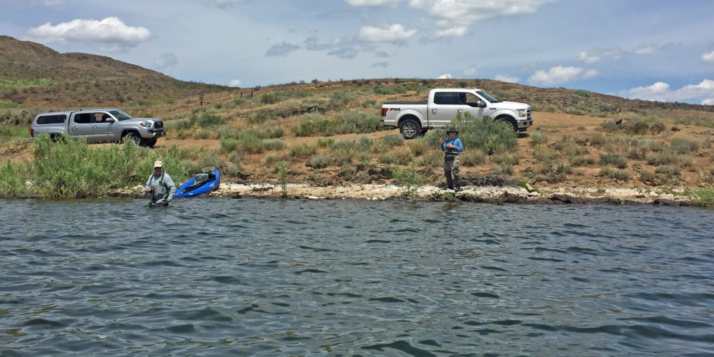
Dave traveled with me in the Fish Taco, and through a bit of luck (augmented by an unplanned 50-mile side-trip through the city of West Wendover, NV) we arrived in Elko about the same time as Bill who was travelling I-80 from Sacramento. Las Vegas to Wild Horse is about 500 miles, but traveling with a buddy makes the travel time fly; the conversation was good and substituted for my usual sight-seeing. About 60 miles north of the city of Ely the US 93 forks into an alternate route to Twin Falls, ID via West Wendover. Needless to say, my jabbering with Dave caused me to miss my exit for the regular US 93 route. My fateful mistake allowed us to have a pleasant lunch together, which also afforded time for Bill and Dave to get introduced. Bill then followed my Tacoma in his Ford Laramie 4×4 quad cab pickup the remaining 60 highway-miles to Wild Horse.
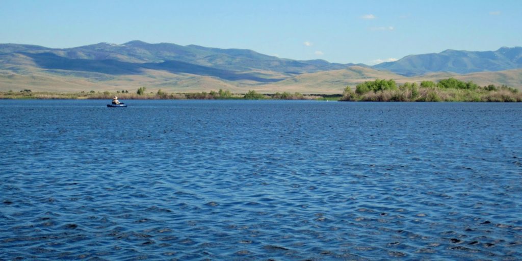
The reservoir at full capacity is huge (2,830 surface acres, 71,500 acre feet of volume). Originally constructed in 1937, the present day concrete dam was built in 1969 by the US Bureau of Reclamation for the Bureau of Indian Affairs. The reservoir impounds the Owyhee River for flood control and irrigation storage, principally for the downstream Duck Valley Indian Reservation (i.e., the Shoshone-Paiute Tribe, also referred to as Sho-Pai). The state of Nevada also maintains the adjacent Wild Horse State Recreation Area with complete campsites, and although there are no RV hookups it does have restrooms and showers available year-round. The summer months also have available centrally located water faucets and dump stations, and pull-through sites will accommodate larger RVs. The camping limit is 14 days in a 30-day period.
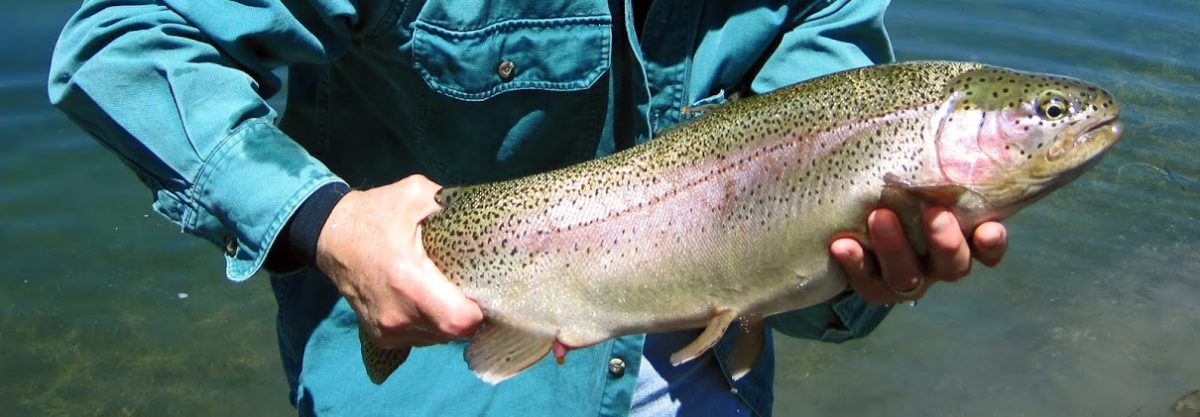
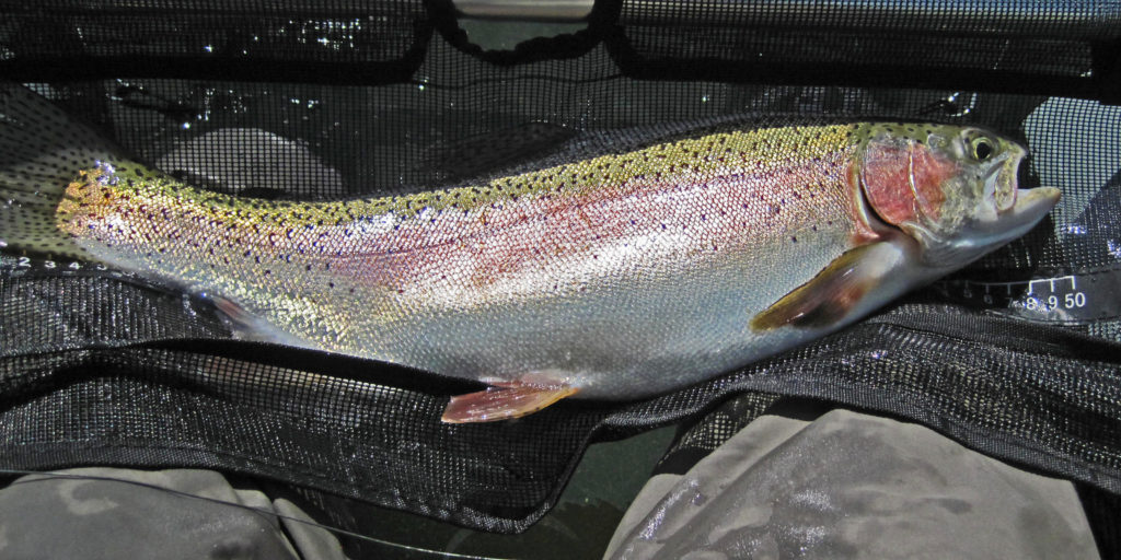
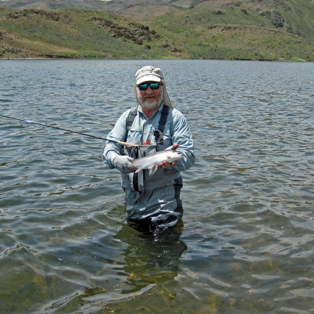
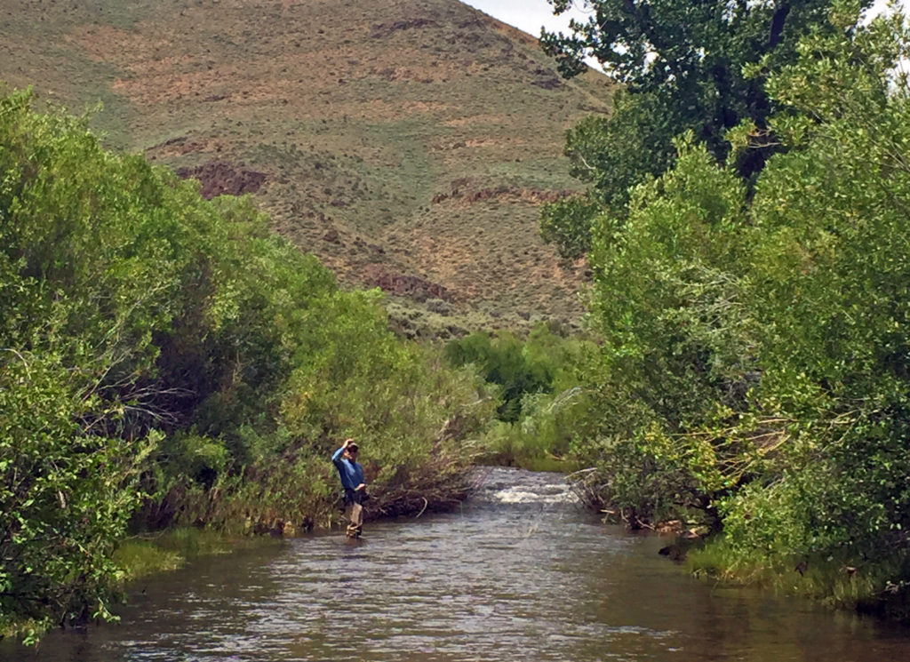
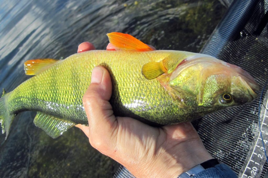
We fished Wild Horse on Monday afternoon and most of Tuesday. Fishing reports already told us that the surface water was warm at 65° allowing the algae to bloom and cloud the water. On Monday we started off fishing the south-east section closer to the Owyhee River inlet. It was quite windy, and none of us did very well that afternoon. But, we “wet our lines” so to speak and got acclimated to the area. Tuesday was much calmer but a little warmer. We took Rick’s advice (and our past experience from April 2015) and headed for the deeper water near the dam. There we did much better. The trout landed were mostly around the 20-inch benchmark (plus or minus… as my friend Chan says, we have “fisherman’s eyes”), although a few were in the 16 to 18-inch range with some nice sized Yellow perch thrown in for good measure. I think the yellow perch were my first ever. I did land two nice Rainbow trout on back-to-back casts, one of which was a legitimate 20-inch female that was still holding her roe. She dropped an egg or two on my stripping apron, and she still wore her scarlet slash that was significantly darker than the other Rainbows I landed.
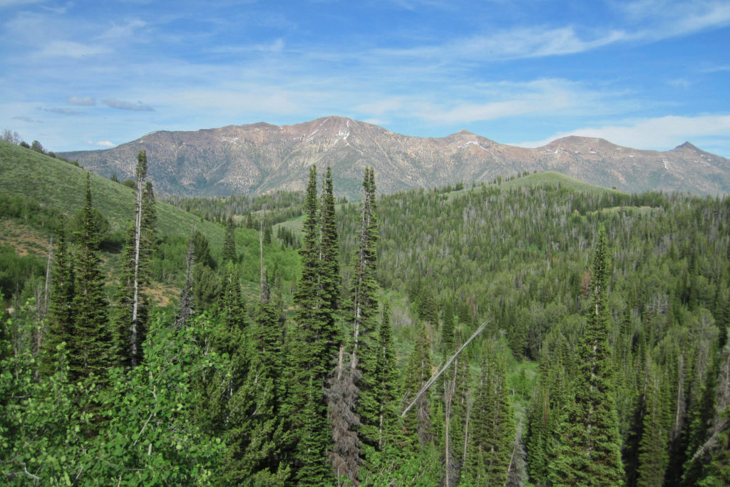
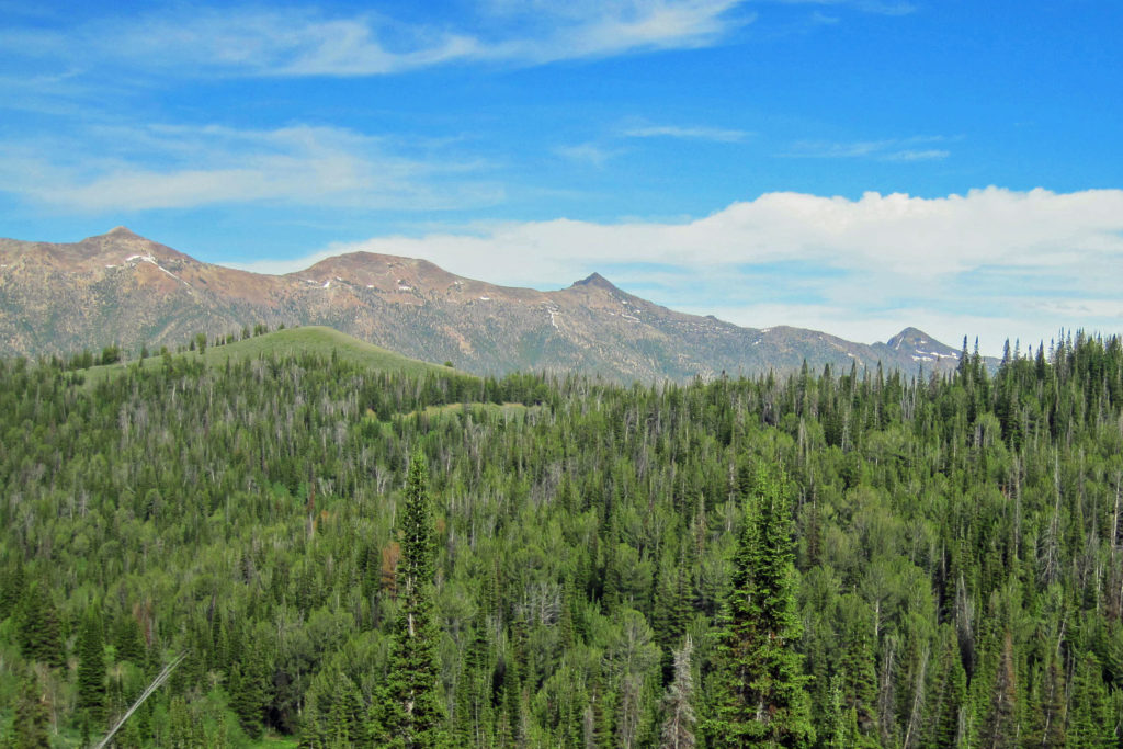
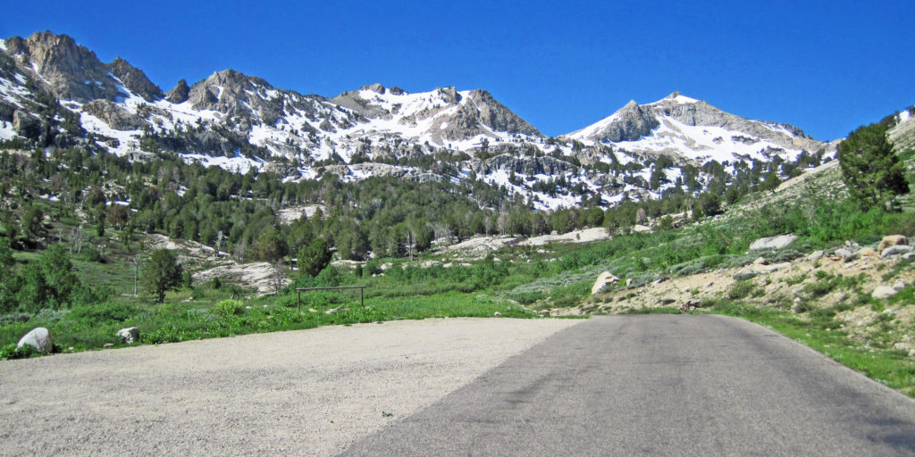
Jarbidge Mountains
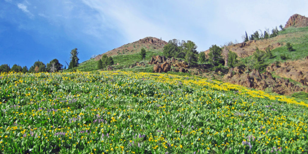
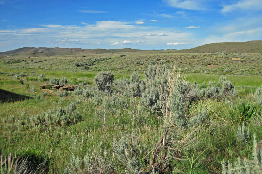
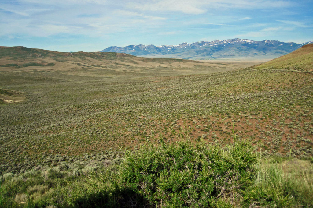
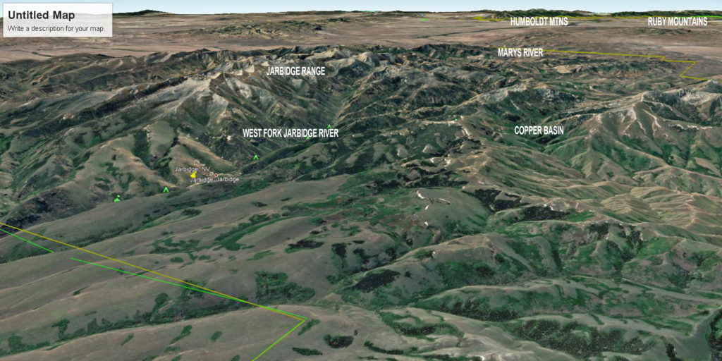
The Jarbidge Mountains are the central attraction in the Wild Horse area. They include multiple sub-ranges, including the Bruneau Range, Buck Creek Mountains, Copper Mountains, Elk Mountains, Fox Creek Range, Ichabod Range, Marys River Range, Salmon River Range and Wild Horse Range. The central spine of Jarbidge extends southward approximately 5 miles from the small town of Jarbidge.
The name “Jarbidge” is derived from the Shoshone word “Ja-ha-bich,” meaning “devil.” The Shoshone believed the hills were haunted. Perhaps it was the hoodoos, pillars of basalt and rhyolite, that could sometimes appear as strange, evil figures that frightened them. For more on the origin of names in Nevada, check out this wonderful 1941 Nevada State Writers’ Project titled: Origin of Place Names – Nevada. Nevada, the 7th largest state at 110,577 square miles, had a state population of about 113,000 in 1940… think about that for a second… one square mile per person! In the hyperlinked Project document, you will find the origin of “Bruneau” on p. 22, “Jarbidge” on p. 25, “Marys River” on p. 26, and “Owyhee” on p. 27. As a side note, I always thought Owyhee (pronounced oh-WYE-hee) was derived from the Native Americans, but it was the influence of Kanakas fur trappers who gave the river its phonetic spelling of “Hawaii.” The Kanakas were workers brought in from the Pacific Islands, thus the Hawaii connection.
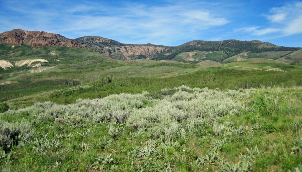
That central core of the Jarbidge Mountains, along with the Elk Mountains, Fox Creek Range and Marys River Range, fall within the Jarbidge Ranger District of the Humboldt-Toiyabe National Forest. The central Jarbidge Mountains and Marys River Range are also included within the Jarbidge Wilderness Area. Most of the other sub-ranges west of the central core are included within the Mountain City Ranger District. The Salmon River Range is the only sub-range not included within the Humboldt-Toiyabe National Forest. This remote country is the type often referred to as “God’s Country” by cowboys and mountain men.
On the western side of the range looking east, the six main peaks from north to south (i.e., left to right) are the Jarbidge, Jumbo, Square Top, Matterhorn, Cougar, and Marys River. My photos do not capture the full spine, so check out this website and click the Jarbidge Mountain photo on the upper right for a full panorama of the six major peaks: Wikipedia: Jarbidge Mountains.
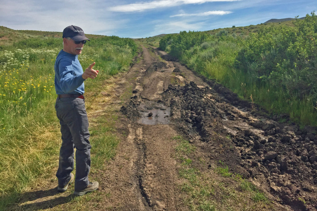
I will be referring to Elko County Roads (ECR), National Forrest Roads (NFR), and National Forest Developmental Roads (NFDR). All three are dirt roads, but NFDR roads often resemble two-track jeep trails. ECR and NFR roads are graded, but can get rutted in the rainy season, and getting graders into the back country for repairs can take longer than you might think.
Marys River
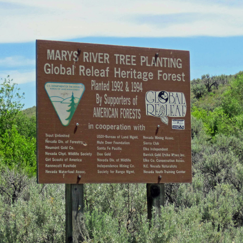
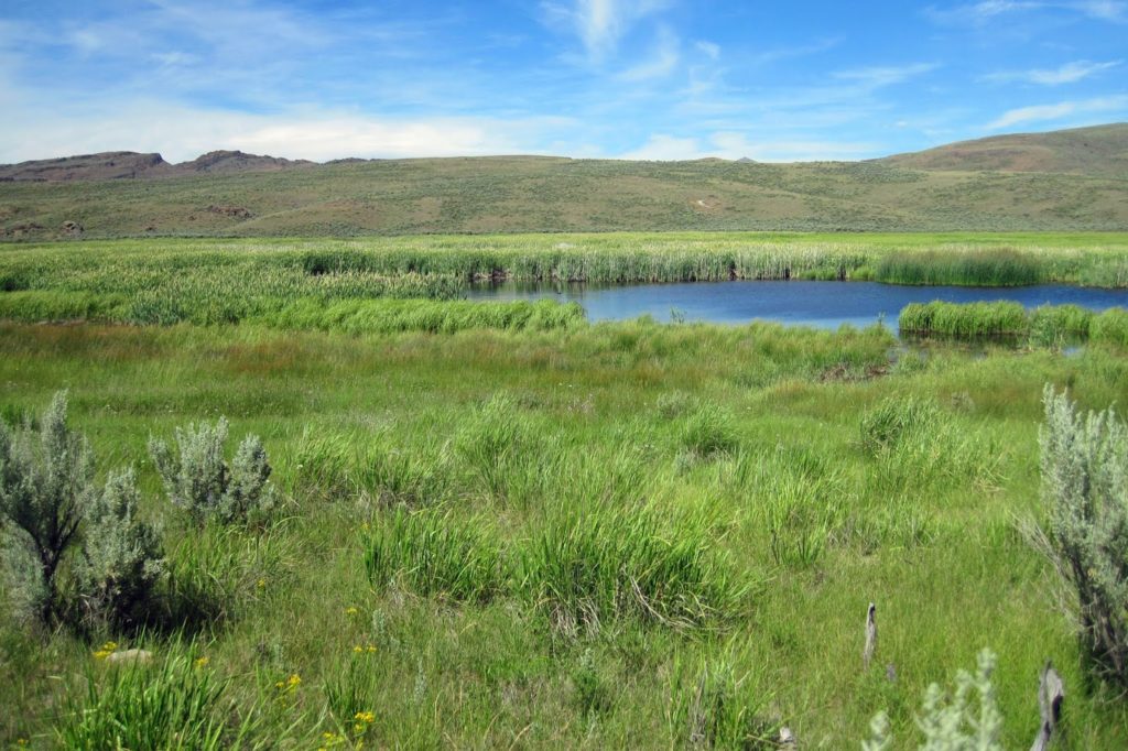
For decades I had been reading about Marys River. Her headwaters originate in the southern-most peak of the Jarbidge Mountains. She begins as the East and West Forks of Marys River on the high slopes of her namesake peak. The combined river flows south and is one of the major tributaries to the fabled Humboldt River that escorted pioneers across the Great Basin to within eyesight of the Sierra Nevada Range. It may have been a member of Peter Skene Ogden’s exploratory party (Hudson’s Bay Company) who gave the river its name around 1820. It’s reported in the book The History of Nevada Volume 1 that one of his members took a wife from the Indian tribe living along the river, and he named her “Mary” and the river “Marys River.” Ogden is credited for the first sighting of the Humboldt River while making his fifth expedition into the Snake River basin that feeds the Columbia River, of which the Jarbidge, Bruneau, and Owyhee Rivers are tributaries.
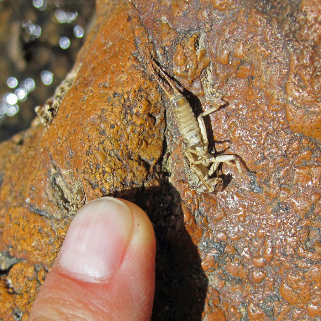
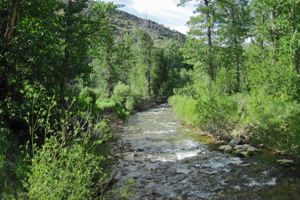
And there’s the NDOW publication “LCT Species Management Plan for the Upper Humboldt River Basin” dated December 2004. It describes their actions to strengthen the LCT in Nevada, including Marys River. Non-native trout have been removed, or at least are no longer stocked in the river. Ranchers aren’t grazing along the river anymore, and with help from many organizations and agencies stream habitat was improved by planting riparian vegetation and replacing impassable culverts under bridge crossings. Although the stream section at the day-use site (i.e., the terminal end of NFDR 306) seemed thin, it did contain some holes of maybe three feet deep. Most of the water was below calf level, but it seemed to have plenty of aquatic life to support trout, including salmon flies, mayflies, and caddis flies.
From my read of the Nevada Department of Wildlife (NDOW) literature, Marys River is being managed as a Lahontan cutthroat trout (LCT) fishery. Pyramid Lake is what comes to mind when most fly anglers think of the LCT, but its historical range is much broader than the Truckee River basin that terminates in Pyramid Lake. The National Fish and Wildlife Foundation paper “A Business Plan for the Conservation of the Lahontan Cutthroat Trout” describes the significance of the LCT and its history of isolation and adaptation throughout the Lahontan Basin (a watershed basin that principally covers the upper Great Basin in Northern Nevada). The LCT is highly distinct from other Cutthroat trout subspecies (e.g., Yellowstone, Westslope, Snake River, Bonneville, Greenback, Rio Grande, and seven others). The most recent discovery of a pure strain of LCT occurred near Pilot Peak in the far northeast portion of Nevada, which Dave and I ironically got a “peek” at when we made our detour through West Wendover. Genetic analysis by the University of Nevada Reno determined the Pilot LCTs matched the original species of the Truckee River watershed, and anglers in Pyramid Lake have already noticed the difference.
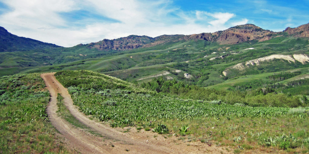
I guess I’m providing all this background as a way to say, although all three of us were skunked on Marys River that Wednesday afternoon, I still believe it’s a very promising river. To be fair to her, we only covered less than a half-mile of water. But I have to admit it was disappointing none of us saw a darting trout running for cover as we lumbered upstream between the willows. Maybe younger anglers willing to hike more of her length will find success. And if nothing else, the drive from Wild Horse to Charleston (ECR 746) followed by NFDR 306 to Marys River is quite an adventure filled with fantastic panoramic views. Again, four wheel drive is recommended on NFDR 306.
Jarbidge River
Leaving Marys River, we headed north on ECR 747 (Charleston-Deeth) towards the town of Jarbidge. Initially the road followed the Bruneau River headwaters, which feeds marshlands on their way into the canyon guarded by Copper Mountain on the east and Pine Mountain on the west (we had plans to fish Bruneau on Thursday).
I was surprised how long it took to drive the 40 miles to Jarbidge. Certainly the photography stops contributed, but many sections of this road will slow you down to 15 mph as it snakes through the Jarbidge foothills. We arrived in the town of Jarbidge around 6pm, with appetites.
If time allowed, and the spirit was willing, I hoped to cast a line into the West Fork of the Jarbidge River. Perhaps as homage to my brother Neal, I felt like I should at least vaguely attempt to catch a bull trout. But when we laid our eyes upon the town of Jarbidge it was hard not to become enchanted by it, and did I mention we were hungry?
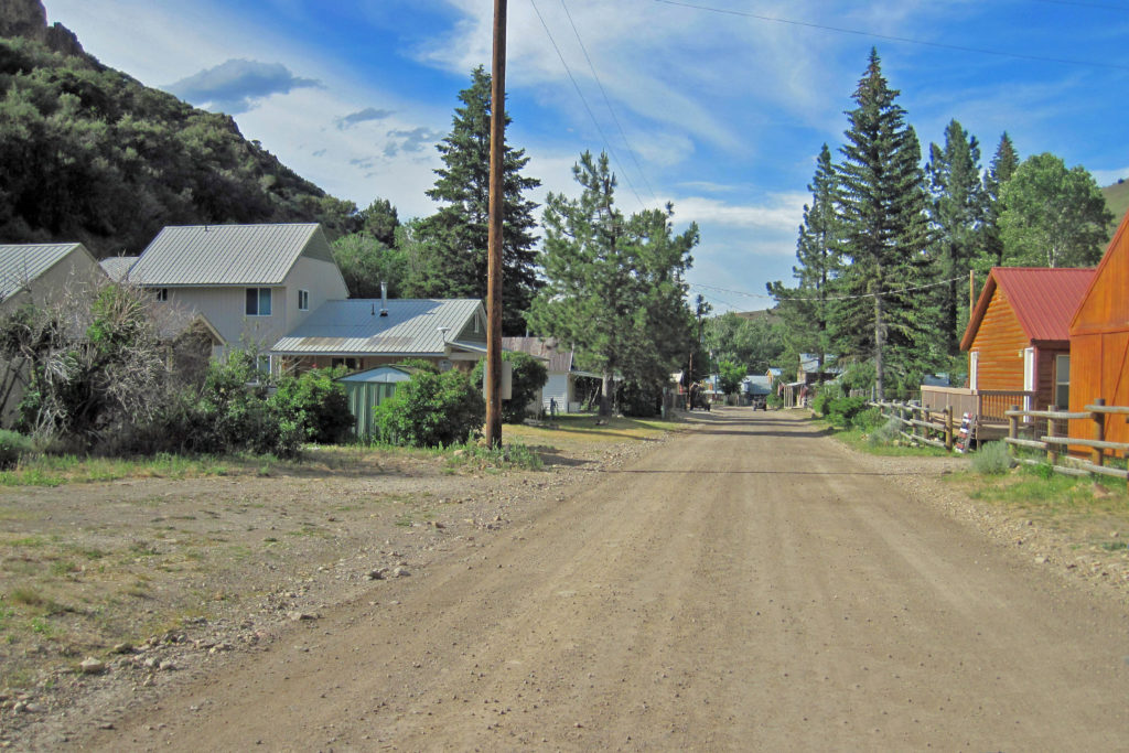
The linear townsite sits in a tight, steep canyon that also holds the Jarbidge River’s west fork. I asked the first resident I saw if gas and food was available. She said “yes” to both, identifying the Outdoor Inn as the place for food and drink. I told her we’d check it out, and she replied that she’d see us down there.
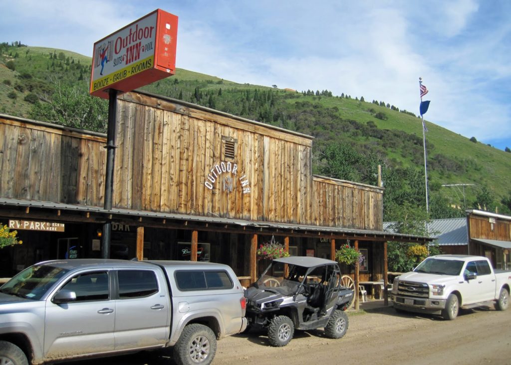
The Outdoor Inn has a small restaurant and a larger bar, but products of both seem to flow freely between. On my way to the bathroom I ran into the lady resident. She recognized me and seemed genuinely glad to see me. We talked for a bit, and I thought to ask her if she knew of Tom Green who used to have a cabin there. Tom was a Deputy City Attorney for the city of Las Vegas. I had many occasions to work with Tom on various contracts, and meeting in his office was always a treat. It was adorned with hunting paraphernalia, including a couple trophy mounts and a vintage double-barrel shotgun hung right under a large photo of Teddy Roosevelt. (There is something respectful about a government attorney who hangs a shotgun in his office.) In the summer Tom often left work on Friday for his Jarbidge cabin, returning to work on Monday; it takes a very special place to cause someone to make a 1,000-mile round trip for essentially one day of leisure. When I mentioned Tom to the lady resident her face lit up, “Oh, yes, I remember Tom! He was our resident lawyer!”
The food was surprisingly good. Much of it is home cooked in bulk by residents like Donna. Donna prepared the spud and leek soup that we three sampled, as well as a bean soup and pie that David especially enjoyed. And the conversations we had were delightful, in a manly way of course. Some guys know how to tell stories, and in the company of Bill and Dave colorful stories kept bouncing across the table. Needless to say the sun was about to set when we left the Outdoor Inn and we still had a 2-hour drive back to the Wild Horse Ranch, so we did not fish the Jarbidge River.
Being that we didn’t fish the Jarbidge River, here’s a quick note about the bull trout of the Jarbidge River. Before the Columbia River System was dammed up, salmon and steelhead ran up through the Snake River and into its Nevada tributaries. The bull trout are a cold-water fish, specifically a char similar to Brook trout. Bull trout, like all char, need relatively pristine streams to thrive. The Bull trout is native to the northwest portions of our continent, and the Jarbidge River might well be its most southern habitation. When river habitat allows, these fish can grow up to 30 inches. They are major predators, as revealed by their massive heads and mouths. In Jarbidge they live in low numbers, and they remain stunted, rarely reaching much over 12 inches. To learn more visit the U.S. Fish & Wildlife Service (USF&WS) website on the Jarbidge River Bull Trout Recovery Team. The team was established in 2005 to restore and protect the bull trout population in the Jarbidge River, which is listed as threatened under the Endangered Species Act. The team is co-led by the USF&WS and NDOW.
Bruneau River
At the Outdoor Inn we learned that part of the Gold Creek Road (NFR 037, which I believe is referred to as the Jarbidge-Bruneau Loop) was rutted out, likely on the portion east of the Bruneau River. Thursday was planned for the Bruneau River’s wild Redband trout at the Mink Ranch crossing.
I was vaguely aware of this Nevada fishery as a blue line on a topo map, and it was the subject of a conversation I had with Tom Green who I believe approached it on a jeep trail from its headwaters behind Copper Mountain. But it wasn’t until I saw a 5-minute YouTube episode by the Theodore Roosevelt Conservation Partnership (Native Trout Adventures: Redband Trout in Northern Nevada) that I got hooked.
It appeared when the video was published in 2011 there was plenty of reasonable stream access. On the day we visited the Bruneau it appeared larger than the Jarbidge, and maybe twice the flow of Mary’s River. We drove a mile or two up a parallel jeep trail (likely the lower section of the trail Tom attacked from the Charleston area), but we literally were blocked out by the thick willows. The two spots we could see for access were tight, but if one of us three senior citizens slipped while wading, the water was deep and fast enough that we’d be swept downstream without many exit points, or even worse we could be caught by a willow sweeper and pulled under and drowned. Between our three brains I think we made the right choice to pass on the fishing that day.
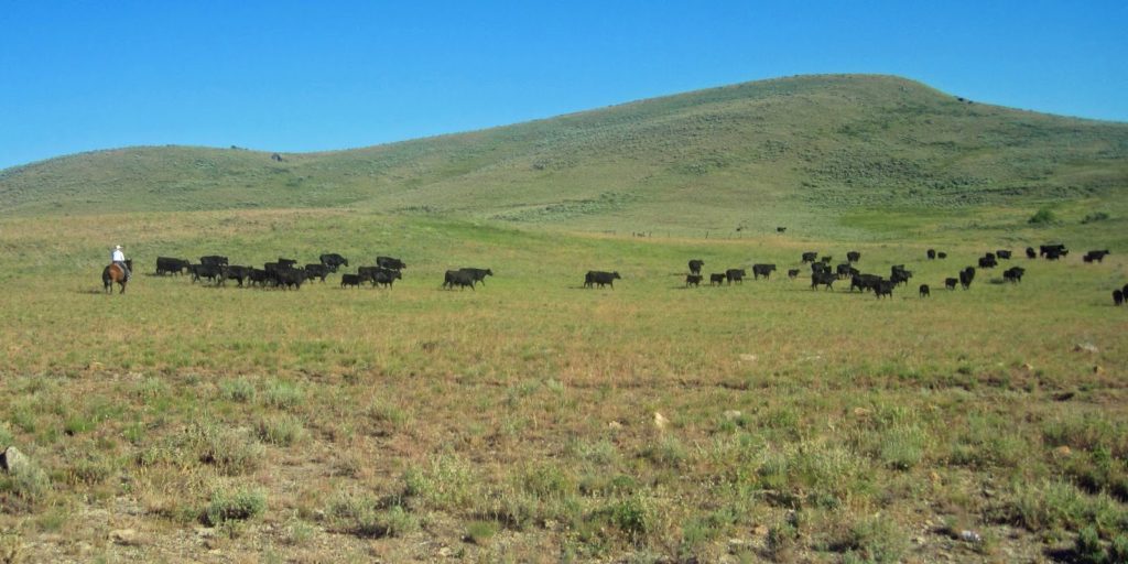
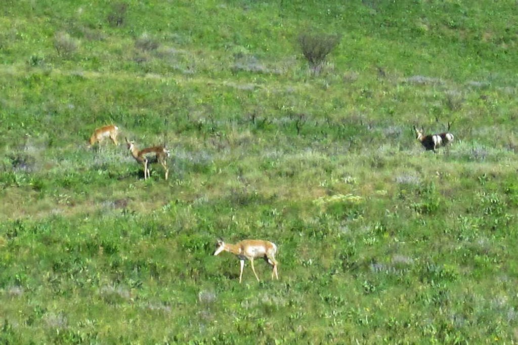
I refuse to apologize for repeating this message, but the drive was really cool. The initial portion through the Wild Horse ranch country brought us to a scene of a single cowboy on horseback moving about 60 head of cattle to a different grazing area with the assistance of thee dogs (from several hundred yards away they appeared to be border collies). We were close enough to hear the cowboy use voice commands to instruct the dogs who in turn managed the herd quite efficiently. It was great entertainment, but more from the perspective of watching work get done well that you don’t see every day. Then, right around the next bend, we spotted about 20 pronghorn antelope on the hillside, most of which were already bedded down. As we crossed the 7,075ft summit just past the Big Bend Campground we left the rolling hills of grass and sage and descended into a canyon abounding with all sorts of birds Dave and I were unfamiliar with, as well as a few grouse and quail that were near the road. Along the way, deeper into the canyon, we ran across interesting rock formations and hoodoos.
Billy Shaw Reservoir
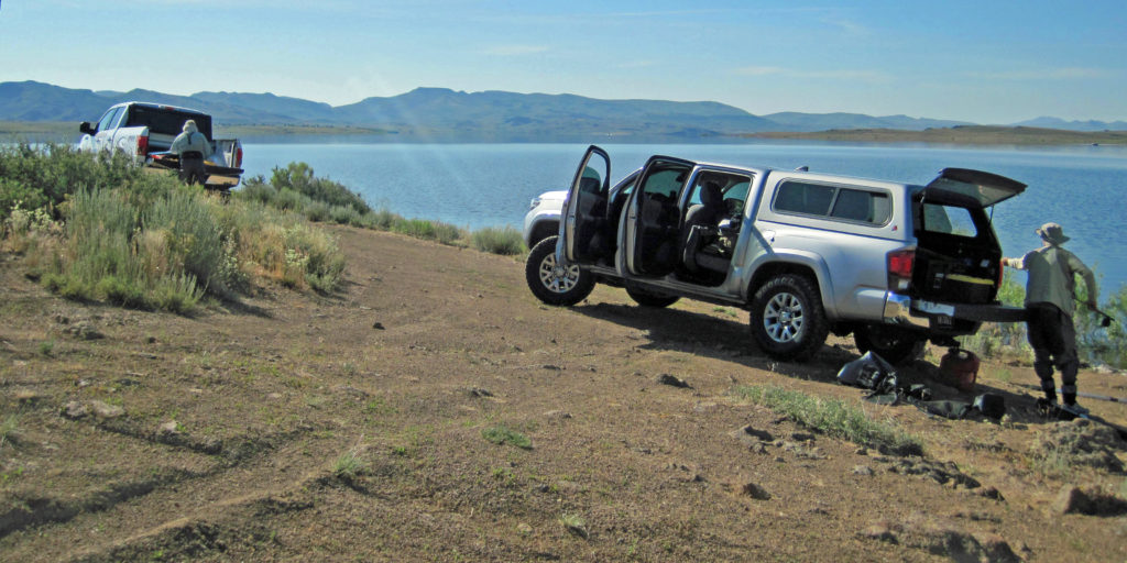
Since we abandoned fishing the Bruneau, we opted to try Billy Shaw Reservoir on the Duck Valley Indian Reservation. Billy Shaw was on my personal list, but I wasn’t sure if we’d fit it into our schedule. I didn’t want to squeeze more into what already felt like a web of interconnected, short day-trip excursions, but passing up the Bruneau created a new opportunity.
The Billy Shaw is artificial-lure-only water managed by the Sho-Pai Tribes (the Reservation has two other fishable reservoirs). The slot limit for trout on Billy Shaw was one trout between 16 – 29 inches per day. Although we were practicing catch & release, the slot limit recalibrates your expectation as to size of these trout. The water was similar to Wild Horse (both are part of the Owyhee River drainage), although about 1,000ft lower in elevation. It falls within what appears to be a massive volcanic caldera due to the obvious volcanic rock on the slopes descending into the valley, but a study of Google Earth doesn’t necessarily support that perception.
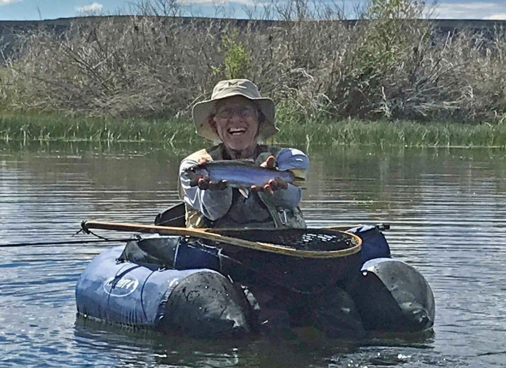
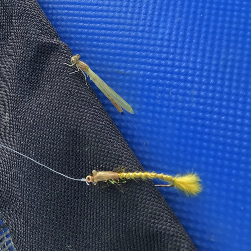
Intermittent clouds and breezes felt good on the water as it was early afternoon when we arrived and the sun was warm at 90 degrees. There is a road that circumnavigates the reservoir with strategically placed pit toilets around it; access for launching tubes can be found near those pit toilets (convenient, eh?). In the arm we launched from the weeds were fairly thick, but the cloud-induced hatching cycles of mayflies and damsel flies revealed a target rich environment. All three of us hooked many fish, a few of which were over 20 inches. But the weeds, and perhaps softer mouths from catch & release, caused us to have great difficulty bringing them to net. The one-fish slot limit forces the catch-kill anglers to release a lot of fish too. My personal experience with Dacey Reservoir’s similar restrictions has been that larger trout accumulate some mouth damage over time – especially from hardware anglers who are allowed on both Billy Shaw and Dacey – which increases the probability of bad hooksets and even pullouts.
Bill started fishing with an intermediate line – or was it floating he changed to – and found a precious little seam of weeds that were hatching mayflies and damsels. One of his methods was waiting for the trout to sip a bug before casting near the spot and retrieving the shallow nymph… almost a simulation of dry fly fishing. He enjoyed his successes and failures for a couple hours.
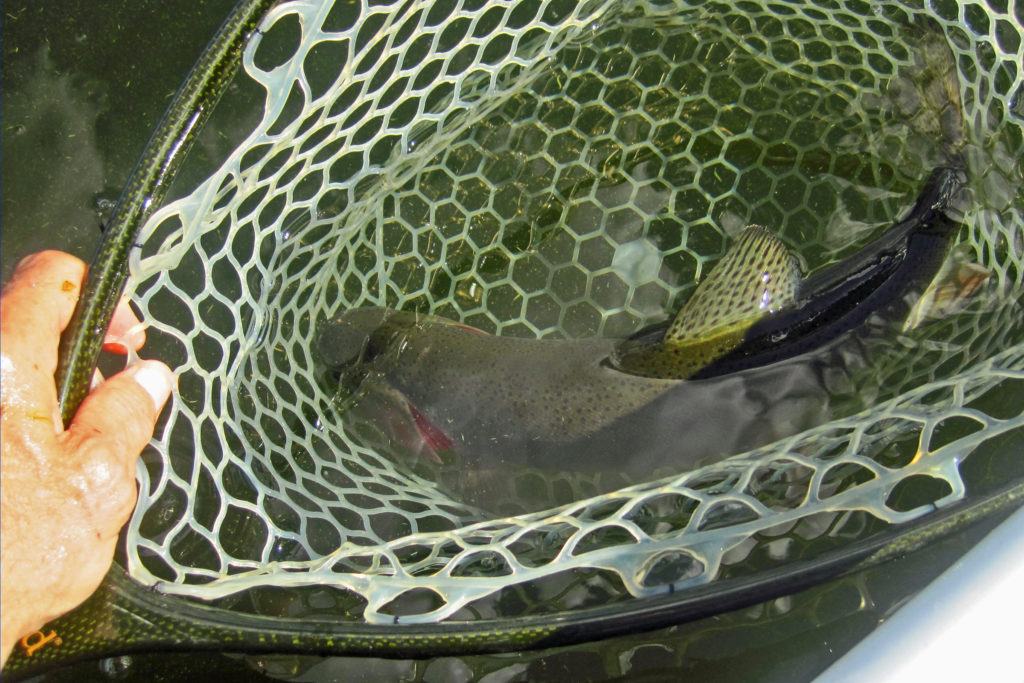
Remorsefully, I was too lazy to return to the truck for my floating line. But I had pretty good success with my full sink line as long as I retrieved it quickly before it sank into the weeds. A couple of the trout I hooked were over 20 inches, but they remained connected to me for less than 60 seconds. Bill reported the largest Rainbow he netted was 22 inches, while David’s was about 19 inches and mine was likely closer to 18 inches. I did land three Yellow perch and one Smallmouth bass which were entertaining novelties. Despite losing many good fish, the action was pretty good for a hot July afternoon.

Savage Gear Model 170 High Rider Float Tube
I used my Savage Gear 170 tube for the first time on this trip. It’s an excellent replacement for my Scadden’s Outlaw Escape that I trashed due to failed warranty repairs… and it’s at least half as expensive. It’s much like a Fish Cat tube, except for its bladderless marine PVC fabric sporting two chambers, and another two bladders for its high-riding seat. The integrated rack-and-pinion oars help make it practical on windy reservoirs. My only complaint is the stripping apron setup is designed more for hardware anglers. Its retention bar tends to move when rowing hard, and the apron area needs to be a little larger to hold fly line. But, that’ll be easily solved with the addition of new D-ring patches and an upgraded apron. So yes, so far I’m happy with the tube, and it is lighter and easier to portage than the Water Master Grizzly, which will still get lots of use.
Gaia GPS App
Because we were planning on driving many dirt roads and trails that I had never driven before I decided to get the Gaia GPS app for backcountry navigation. The basic app is free, and it works with your device’s GPS even when you don’t have cell or Wi-Fi service… just what you need in the backcountry. A $20 annual upgrade fee gets you access to additional map layers, and the premium level adds additional maps and features. You can run the app on your PC or laptop creating routes, and then create areas on the map that contain your routes. Then using your mobile device you save the areas in your memory for future use in the backcountry. One word of caution is that if you make your map areas too small you’ll lose your map reference once you drive outside its boundaries. Bill was also using Gaia, and he saved larger areas which was a lesson for me.
A few months ago I tested the app with my son Brian on the Potosi-Goodsprings road by activating the phone’s airplane mode, and it worked very well. On this trip I saved an area that included all the aforementioned Elko County and Forrest Service roads. I was very impressed with the apps accuracy on the Jarbidge backcountry roads. All campers, hunters, and fisherman who like exploring backcountry should seriously consider this app.
Hitchhikers
Dave and I took a detour on our way home on Friday so that we could drive through the Ruby Mountains, aka The Alps of Nevada. Dave had never seen them before. We drove up Lamoille Canyon, through Jiggs, and over the Harrison Pass to the Ruby Lakes. Continuing south we took White Pine County Road 3 through Long Valley to US 50.
Long Valley is a fairly desolate pace, but it gets some traffic from those exploring the Rubies as well as those working the mines in the area. Still, breaking down on this stretch in the summer is not pleasant. After passing by a large gold mine operation in the Bald Mountain area, we descended into Long Valley and soon noticed a truck on the side of the road. It was an older man and perhaps his grandson, but they were just taking a break and so they waived us on.
About 10 miles farther we noticed a yellow GM Hummer on the side of the road. This time when we slowed down a gentleman stepped out. He was about our age or younger and he was holding a cell phone. I already knew his phone was out of service. I also noted the initials “VI” were on the truck’s left-front quarter panel, and the gentleman was nicely dressed in a casual sense wearing leather penny loafers without any socks. He asked for a ride into the city of Ely so he could get help to fix his truck, so we made room for him by moving stuff out of the cab into the camper shell.
On the drive to Ely we discovered that he was Sr. Vice President of Business Development for Vezer Industrial Professionals. His name was George. He was visiting a list of mines in Nevada that were his customers, like the Bald Mountain mine we had just passed. George’s expertise became a great opportunity for Dave who has an interest in gold mines and their operation. So, in another turn of fate, otherwise known as a “God wink,” a minor good deed returned an interesting conversation that revealed new knowledge. And of course all this discussion made the 4o miles to Ely pass very quickly.
Good Friends
Although I appreciate the solitude of traveling alone (a.k.a., meditative quiet time), nothing beats the company of good friends. Friends of integrity and good character lift and support each other. Good friends who share a passion with you are willing to share experiences with a giving heart. Friends who have a cultivated and sometimes sharp sense of humor (that is seldom, if ever, inappropriate) create laughter and hilarity that wash away disappointments. I consider Bill and Dave to be such friends, and I know they feel the same about me.
Dear FisherDad,
Thank you for another captivating, refreshing, and encouraging blogpost. Your writing always touches my spirit deeply, inspiring me to move closer to others and to the Lord.
I pray that God continues to give you the desires of your heart in this lifetime.
Thanks again,
Randy
You know Randy, I always pray the Holly Spirit writes words through me that encourage and reaffirm both believers as well as those who don’t know our Lord Jesus but are seeking answers. Sometimes the words just seem to come, and other times it takes prayer, patience, and thoughtful reflection on my part. Unfortunately, there are also times I seem to be out of touch and lost for words, like those times when my own “idols” seem to entice me away from the one true God. I’m sure you understand what I mean, and so I pray that the Holy Spirit continues his work through your various ministries as well. There’s a reason the 1st of the Ten Commandments declares:
“No other gods, only me. No carved gods of any size, shape, or form of anything whatever, whether of things that fly or walk or swim. Don’t bow down to them and don’t serve them because I am God, your God, and I’m a most jealous God, punishing the children for any sins their parents pass on to them to the third, and yes, even to the fourth generation of those who hate me. But I’m unswervingly loyal to the thousands who love me and keep my commandments.” (Exodus 20:3-6, MSG).
Some might think my posts contain too much of my personal information; who really cares about an old narcissistic fisherman’s rambling thoughts about his personal history and its impact on his fishing trips anyway? My only defense is that sometimes the Holy Spirit uses the details of events and experiences in our own lives to move others who might be struggling in their search for the Truth. We connect through our shared experiences, especially those that test us. My prayer remains for the Spirit to provide relief, encouragement, and maybe even redemption for those suffering because they do not know, love, or submit to Jesus.
Thank you, my Brother in Christ.
– Mark
Mark,
Thank you for your developed and extremely informative response. I'm strengthened and inspired that you seek and are guided by the Holy Spirit in your writing and in your life.
The Holy Spirit gives us wisdom, guidance, and inspiration and I am encouraged that you follow His leading so faithfully.
Your FisherDad Blog touches hundreds, if not thousands of readers, in ways that transcend fly fishing, adventure, and your insightful observations. You point to the eternal in your writing and nothing could be more relevant and significant to your readers.
Thank you, Mark.
Randy
Looks like a beautiful trip. I have always wanted to get up to Jarbidge. Those peaks really do evoke the description of God's Country. Looks like good fishing to my untrained eye. Great blog!
Mark,
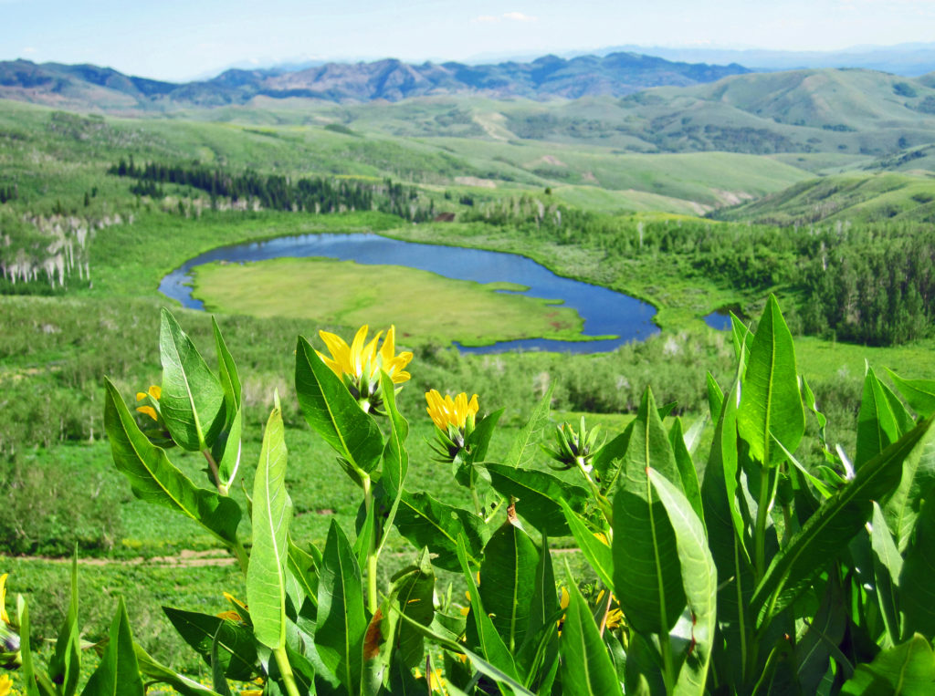
Thank you for your reply. Your photo of the wildflowers in the aspen grove is excellent! What a beautiful spot. Yes, I agree about Elko County. I finally got into the Rubies last summer and went backpacking up over Liberty Pass to some of the lakes in the Kleckner Creek basin. Gorgeous area – saw lots of fish in the lakes. The Independence Range looks nice, especially the Jack Creek area.
Take care,
Joe
Joe –
So glad you posted a comment. I added three more photos to the blog; see if you can find them. It's a long drive but well worth it to explore Elko County. Between the Humboldt, Ruby, Independence, an Jarbidge mountain ranges there is so much to explore. It is overwhelming country, a Nevada jewel.
All the best to you.
– Mark
Joe –
Yes, the Rubies are quite spectacular with their 20+ alpine lakes not to mention wildlife unusual to Nevada like mountain goats, Rocky Mountain bighorn sheep, and Himalayan snowcock. You might have seen it already, but if not cut&paste this blog of a backpack trip from 1979:
https://www.fisherdad.com/1979/07/15/ruby-mountains-elko-nv/
– Mark
Wow!! Only got through half of it but am looking so forward to the rest. Pics of Neal & Dept NV Fish & Game priceless. You have such precious memories of Neal & I was able to read them & think about them & I thank you for that. The wealth of information on everything is impressive & again I thank you for that! The pictures are gorgeous & I want to take Mike there & possibly use RV area. Have a happy birthday Sunday! =))
Hey June!
Coming from SoCal it's an even longer drive to the Elko area, but stopping midway in the RV would make it reasonable. If you were retired to the Washoe County area (e.g., Reno), the I-80 freeway to Elko is only about 290 miles, kinda like LA to Vegas but with much less traffic.
Love you sis!
– Mark