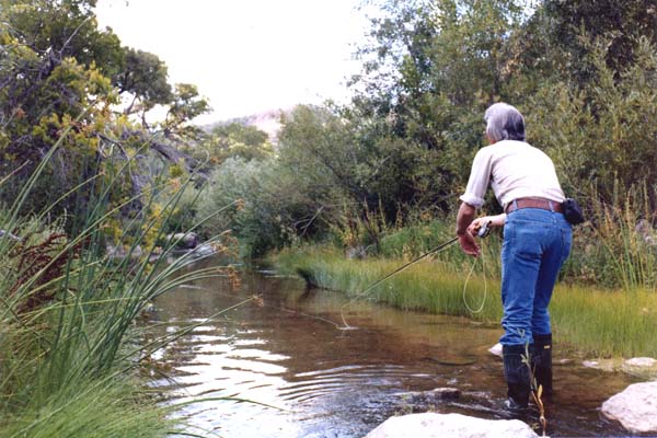
Beaver Dam Creek is where I learned the subtleties of fishing a small stream. Stalking is the name of the game on that modest creek. It was a fine place to become educated in the way of the trout and the tactics necessary to catch them with a fly.
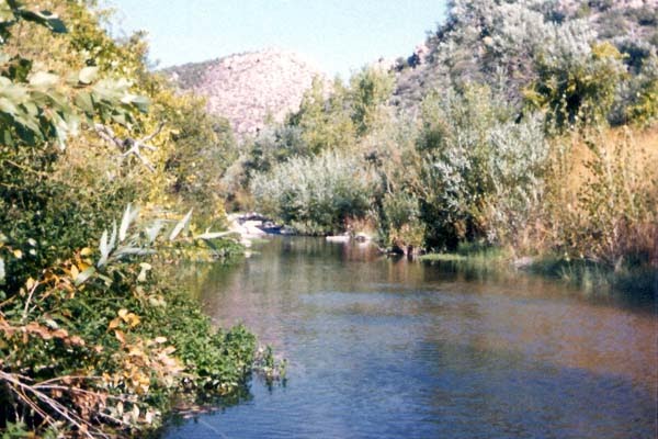
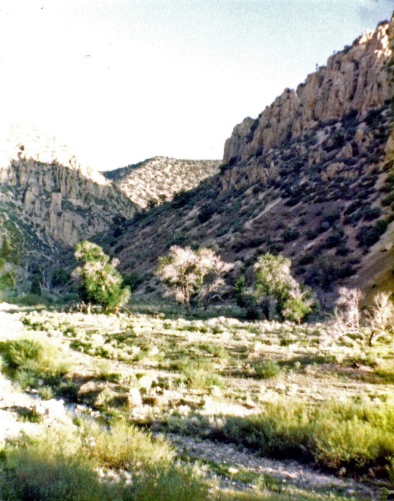
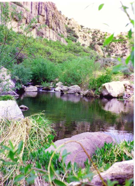
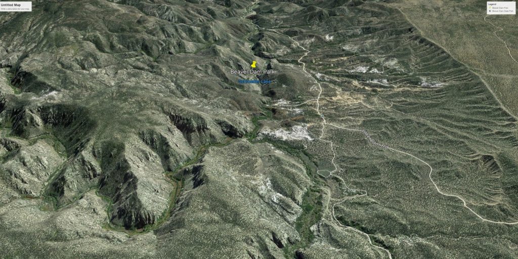
Beaver Dam Creek flows southerly from springs in both southeastern Nevada and southwestern Utah, and the Nevada State Parks Department capitalized on the resulting confluence by creating a recreational lake called Schroeder Reservoir. The reservoir resided in one of the prettiest of Nevada state parks, Beaver Dam State Park. For decades the Nevada Department of Wildlife planted Schroeder Reservoir with rainbow trout, and they would spawn upstream in the springtime. Some trout went downstream slipping over the spillway where they developed into a self-reproducing population of small, but wild rainbow trout. The park is quite remote, in the diminutive rolling mountains northeast of Caliente, Nevada. The park is accessed via a thirty mile dirt road that traverses hilly country speckled with pinon and juniper trees; it is not very accommodating to the family car. Unfortunately, time and remoteness deterred the Parks Department from maintaining the earthen dam, which deteriorated to the point that they had to destroy it in 2005 to prevent an accidental breaching which would endanger the downstream ranches. As of 2007, no plans seem to exist regarding its reconstruction. Ultimately, the creek flows south crossing into Utah and then Arizona until it trickles into the Virgin River, between Mesquite, Nevada and St. George, Utah. The Arizona town site near the confluence is actually called Beaver Dam, and it can be seen from Interstate 15.
My first visit there was in the spring of 1977 for a backpack trip with Kevin McGoohan. Although I don’t recall, most likely we were on Spring Break during my junior year at UNLV. This creek was another one of those trout places I learned about from my brother Neal. In discussions with Neal about his Nevada fishing trips he always left me with the sense that this was a favorite place of his during the 1970s. For many years a picture hanging in his apartment of a thirteen-inch buck rainbow in spawning colors gripped my imagination. He never mentioned fishing upstream, and my love for adventure lured me to suggest to Kevin that we backpack upstream towards the Utah border.
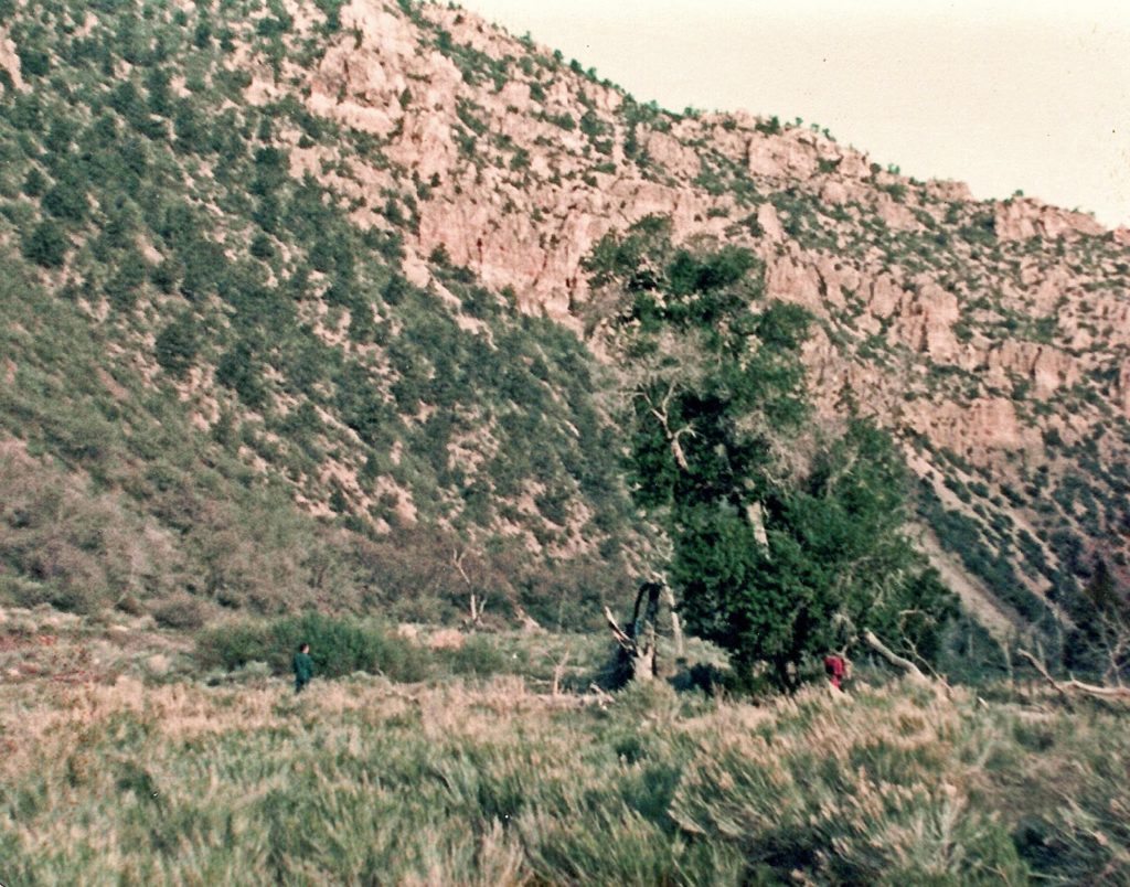
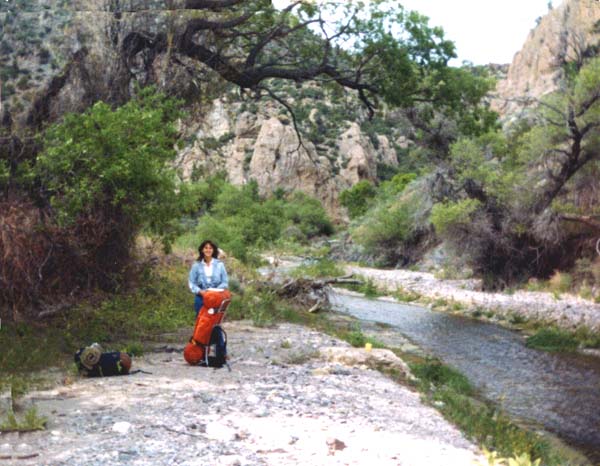
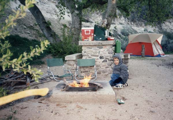
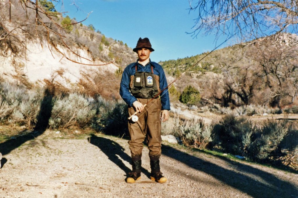
From 1977 to the early 1980s I made several trips every year working on my skills as a fly fisherman. I built a fly rod specifically with this stream in mind; a six-foot, four-weight rod that could make a nine-inch trout feel like twelve inches. Often I made these trips by myself, but sometimes I brought company. Beaver Dam is where I introduced Bill “Bergie” Bergan to the spell of fly fishing. (I am not proud of my youthful ways before accepting God’s truth, but one night of impaired judgment caused me to concede to let Bill teach me rock climbing if he would let me teach him fly fishing; some deal, eh.) In the spring of 1981, I took Denise on her first and only backpack trip to the very spot where Kevin and I camped. She was a great sport, never complaining. But we were only married less than two years, and she’s never backpacked or camped with me since then. Although not her cup of tea, I am thankful she allows me these indulgences.
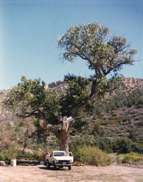
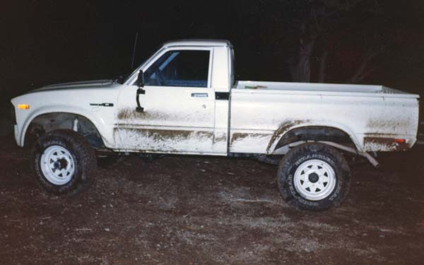
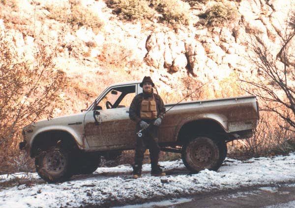
I made three trips in the spring of 1982, including one in March when I almost lost my Toyota 4×4 in the flood water below the spillway. The above picture of the truck, taken around 11:00pm Friday, clearly shows the high-water mark at the height of the 30 x 9.50 R15 tires. I left for Beaver Dam shortly after work and arrived in the darkness of night. The flood waters caused me to change my mind about camping below the reservoir and I turned around. Engaging second gear, low range of four wheel drive is clearly what prevented me from getting stranded in the creek. The little Toyota pushed across and upstream into the water causing it to back up in front of the radiator and then start up the engine hood. Good thing I had already cut-off the air intake pipe that sucked air from the front of the engine compartment, otherwise it would have sucked water and stalled mid-stream. I might have ended up in the Virgin River.
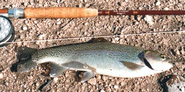
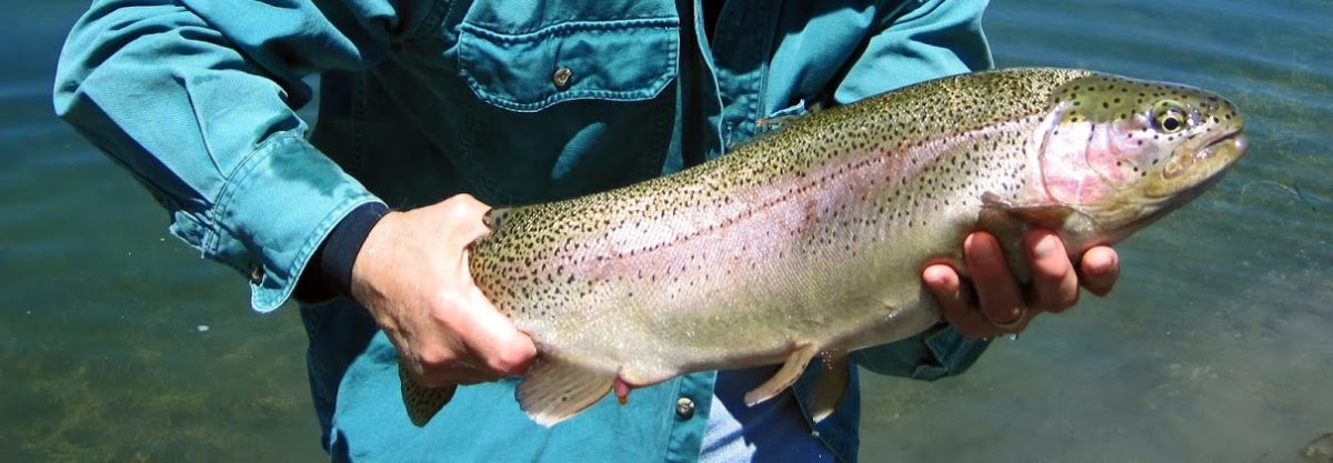
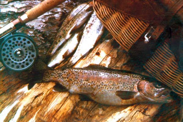
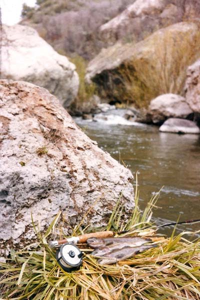
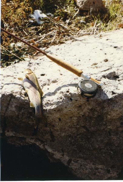
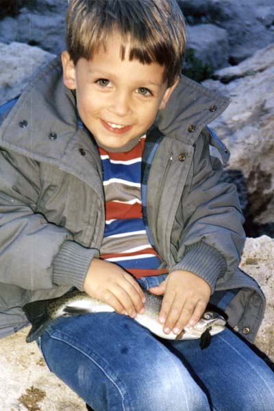
In the fall of 1982 I built Neal a seven and one-half foot, five-weight rod for Christmas, and I just had to field test it in late October before wrapping it. That was my most memorable Beaver Dam trip to date. It was common in those years to catch twenty to thirty trout in a day of fishing, but most were in the eight to ten inch range. They were beautiful, however, with golden bellies and gill plates with the signature crimson rainbow stripes down their sides. They were always heavily spotted, not silvery like you would expect with hatchery-raised trout. However, that October trip produced two real nice trout: a fourteen-inch rainbow in the big pool at the bottom of the spillway, and a twelve-inch beauty in a secret little honey-hole. I landed numerous other trout, but nothing as memorable as those two.
I still enjoy fishing Beaver Dam, but it’s not the same for some reason. Maybe it is because I am older and less limber, a critical factor for stealthy, crouching approaches to these skittish, wild trout. In fact, in August 2002 I snapped back my ring finger after slipping off a rock (well, I had to save my little six-foot rod so I held that high in my right hand while bracing for the fall with my left). I dislocated my left-hand ring finger, but was able to snap it back into place. For a while I had to wear my wedding ring on my right hand… it wouldn’t fit on my left hand.
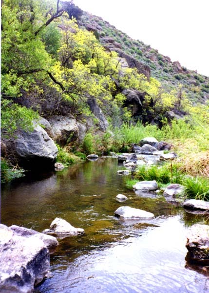
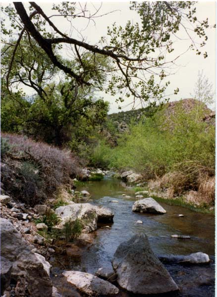
In addition to the wild trout, Beaver Dam’s other attraction is its remoteness. In the first fifteen or twenty years I fished it you needed four-wheel dive to access the “wilderness campground” below the spillway where the best fly fishing was to be found. I believe that two-rut jeep track, coupled to the end of the thirty-mile dirt road into the park that gets quite gutted and muddy when it rains, keeps out the rift raft, so to speak. For me, that effort was always worth the seclusion and the reward of those wild little rainbows.
good read! thanks!
Thanks! What caused you to find this blog on Beaver Dam State Park; have you been there?
I’ve fishing Beaver Damn Wash mainly downstream coming up from Motoqua intermittently for the last 15 years.Have fished the State Park but I only fish it in winter and warmer at lower elevations plus I needed an out of state license. It was more reliable while the reservoir was there but if I work up far enough I usually find trout. Moved away from Utah 3 years ago. Last trip must have been 4 years ago. Caught 20 trout including my first ever Cutthroat trout there in 3 hours fishing plus a good 90 minutes of hiking in and out. Nearly I recall.it being above 60 degrees in February on the way up but quite cold on the way out as the basalt canyon blocked the sun later in the afternoon. Hoping to hit it in the next 6 weeks.Thanks for the post as there aren’t many that take the effort to enjoy the solitude, scenery and sometimes surprisingly good fishing. . I’ve caught 14-16 inch rainbows there on multiple trip even if the fish usually average 10-12 inches .-Riverdog
Riverdog –
Thanks for taking the time to post. Your comments are timely. I've been contemplating Beaver Dam Creek lately, thinking that upstream from the old Schroeder Reservoir site could be a good bet. I too was thinking of late February. March can be iffy with higher water flows, and I'm too old now to fight with snow of any sort. There seem to be quite a few beaver dams on the creek nowadays; the DFW doesn't seem to discourage them anymore like they did back in the 1980s.
Please post comments on your experience if you visit the creek in February.
All the best,
– FisherDad
Didn’t do well over Presidents Day coming up from Motoqua.. Low water takes its toll on the fish lower down as you approach the upper edge of the Mohave Desert. One of the few streams you can sometimes catch trout next to native Joshua Trees. Next week I’ll be back in SW Utah and hopefully I will find time to fish it out of Pine Park in Utah above the State Park. I’m told the fish are still in there despite the past low water year. Nevada will probably stock it this spring but probably not before I go. Unfortunately the fish don’t reproduce well or flourish on the lower water years.Did you go? If so any luck?Riverdog
Riverdog –
No, I have not made it to Beaver Dam Creek yet. Lots of excuses, but the main one was that our family got that sinusitis/rhinitis/ear infection bug that started in early February and hung on right through most of March. In fact, my youngest son just got it and is now on antibiotics. I promise that if I get there this spring I will post a blog; I haven't given up on her yet.
– FisherDad
Riverdog –
BTW, do you work at the D I Ranch in Motoqua, or just drive up through it on way upstream? If the latter, is the road accessible through the ranch (and other upstream ranches) all the way to the Nevada boarder?
Interesting history, that ranch in Motoqua, UT…
– FisherDad
I’ve been doing a little fishing on the east side of the Pine Mountains last few days. More of the same today but hopefully I’ll fish BDW in Pine Park tomorrow. In the past I drive up the road above Motoqua through the ranch. Very rough above the ranch but I can usually get upto the old cabin. Not sure if this is Holts Cabin as there were 2 up there until one burnt down about 8-10 years ago. The area about a quarter mile above the cabin now has wilderness area designation. The road through there built in the 1930s went upto the State Park. It’s mostly gone but there are a few stretches of road bed in there up above the stream if you look closely on the West side. The area gets tremendous floods roughly every 30 years that long ago took out 99% of the road. The last flood on that level was 2005 and it was the one that damaged the reservoir. There was debris 30 feet up in the cottonwoods after that flood.. I own the last stretch of Beaver Dam Wash in Utah on the Arizona border. It’s now an edgeholding to the BDW National Conservation Area. The water is usually underground there and only flows above ground intermittently. . After the 2005 flood the water flowed above ground for many months. The lowest spot in Utah is on that property. That flood lowered that further by about 5 feet due to erosion- I think it’s about 2165 feet now. Quite a sight to see as it looked like the Colorado River at its peak flow stretching across the entire half mile width of BDW at the AZ border.Riverdog